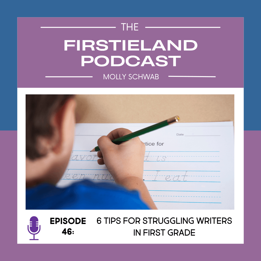
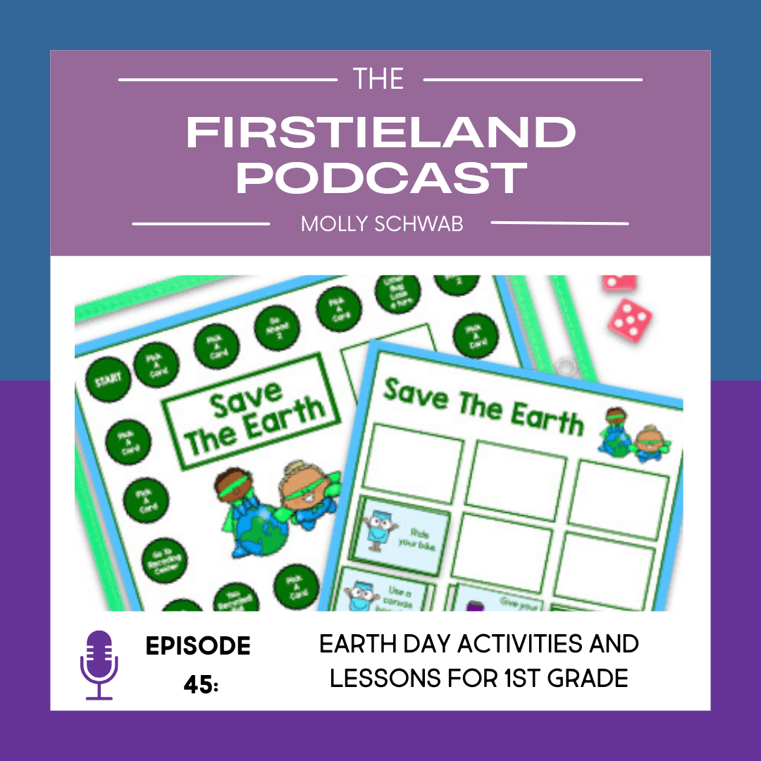
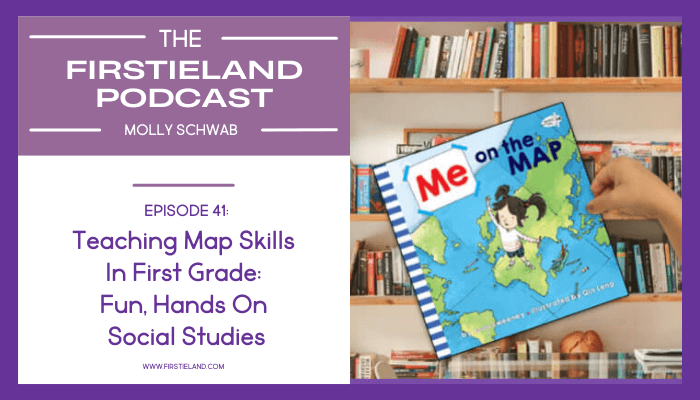
Click Play to Listen

Episode 41

Teaching Map Skills in First Grade: Fun, Hands-On Social Studies Activities

Teaching map skills in first grade is an important social studies skill. And here’s why – we’ve all become pretty dependent on GPS.

We plug in an address, follow the voice, and get where we need to go without thinking much about it. But what happens if the sound cuts out? Or the signal drops? Or there’s no service?

Most of us would feel a little lost.

And that’s exactly why teaching map skills to elementary students still matters.

Even though our students are growing up in a world of electronic navigation, understanding how maps work is an important life skill. In first grade, it’s also a social studies standard. The Ohio Learning Standards state that students should understand that “maps can be used to locate and identify places.”

That sounds simple, but for young learners, it requires building strong spacial reasoning skills and helping them understand how symbols represent real-world places.

The good news is that teaching map skills in first grade doesn’t have to be complicated or boring. When it’s interactive and hands-on, students really get it.

Start Small to Build Spacial Reasoning

Before jumping into large maps, begin with places students already know well, like their bedroom or your classroom.

Have them draw a simple map from a top-down view. This shift in perspective strengthens spacial reasoning and helps students understand that maps are representations, not pictures.

When they see how their desk or bed looks from above, the concept of mapping becomes much more concrete.

Teaching map skills in first grade

Teach Map Key and Symbols Clearly

One of the biggest “aha” moments for first graders is understanding that maps use symbols instead of real images.

Explicitly teach how a map key works. Show a real picture of a place, like a school or fire station, and then show the small symbol that represents it on a map.

We used this pocket chart activity where the kids had to match a picture of a real place to its map symbol.  When students connect real places to symbols, the map key suddenly makes sense.

Teaching map skills in first grade

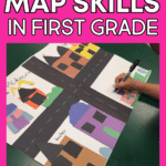
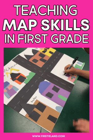
Create an Interactive Map of Your Town

One of the most meaningful ways to teach map skills to elementary students is through an interactive map project.

Have students work in small groups to create a map of your town. Provide a large sheet of paper with simple roadways already drawn. Students can build construction paper buildings for places like:

  • School
  • Hospital
  • Fire station
  • Grocery store
  • Church
  • Park

Then have them create a map key in the corner explaining what each symbol represents.

It may be a little messy, but it builds understanding in a way worksheets simply cannot.

Teaching map skills in first grade

Introduce the Compass Rose and Cardinal Directions

Once students understand basic map layout, introduce the compass rose and the four cardinal directions: north, south, east, and west.

Keep it simple and concrete.

Use an interactive map activity where students follow directions like:

  • Place the cow north of the barn.
  • Put the pig west of the fence.
  • Glue the house south of the road.

Practicing cardinal directions in a hands-on way helps students internalize how a compass rose works.

Teaching map skills in first grade

Practice Following Directions on a Map

To strengthen understanding, give students simple maps with a map key and have them follow directions from point A to point B.

For example:

Start at the school.
Go to the post office.
Stop by the fire station.
End at home.

Students draw the path along the roads, reinforcing how maps help us locate and identify places.

This type of activity strengthens logical thinking and spacial reasoning.

Teaching map skills in first grade

Why Map Skills Still Matter

Even in a digital world, understanding how to read a map builds independence and critical thinking. Teaching map skills in first grade gives students the foundation to understand symbols, use a map key, interpret a compass rose, and apply cardinal directions confidently.

More importantly, when lessons are interactive and hands-on, social studies becomes something students enjoy.

Maps are more than paper tools. They help us understand where we are in relation to the world around us.

Teaching map skills in first grade

If you’re looking for ready-to-use activities to support teaching map skills to elementary students, including map key practice, symbols, compass rose activities, and interactive map projects, you can find everything here.

WATCH ON YOU TUBE

Teaching map skills in first grade

In this episode, you’ll learn:

✔️ Why map skills are an important first grade social studies standard
✔️ How to build spacial reasoning through simple mapping activities
✔️ How to teach map key and symbols so students truly understand them
✔️ Easy ways to introduce and practice the compass rose
✔️ Hands-on activities for teaching cardinal directions
✔️ How to create an interactive map project your students will love
✔️ Simple follow-the-directions activities that build confidence
✔️ Why keeping it hands-on makes social studies more effective

Resources Mentioned

Map Skills Unit – https://firstieland.com/map

Related Blog Posts / Podcast Episodes

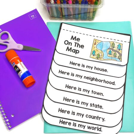
Blog Post – Teaching Map Skills to Elementary Students With Me On The Map

Connect With Molly

Follow on Instagram: @firstieland
Follow on Facebook: Firstieland

Save This Podcast For Later!

Take a minute to save these ideas to your favorite Pinterest board so you can remember them later!

Teaching map skills in first grade

More About The Firstieland Podcast

Hosted by Molly Schwab, a retired K-1 teacher with over 30 years of classroom experience, The Firstieland Podcast For Early Elementary Teachers gives kindergarten and first grade teachers practical, real-world tips to make teaching easier and more fun. From classroom management to picture book ideas, each episode is designed to help you teach smarter, not harder.

Each week, Molly shares practical tips, strategies, and ideas to help kindergarten and first grade teachers feel confident, organized, and ready to create a joyful classroom where learning feels like play.

Tune in on your favorite podcast platform: Apple, Amazon, Spotify, and more! If you’re loving the podcast, please rate, review, and follow!

Click to View Transcript

[00:00:00] Hey friends. Welcome back to the Firstieland podcast. I’m your host, Molly Schwab. The other day, I wanted to take my granddaughter to a special dollhouse and miniature store that was a little bit over an hour away. So I plugged my phone into the navigation system in my car, and off we went. Well, about halfway there, the sound stopped working and I couldn’t hear my little buddy with the Australian accent who tells me how to get places.

The screen was still working, but there wasn’t any sound, and I was in a little bit of a panic because I kept having to glance down to make sure we were going in the right direction. And it got me to thinking, what would we do without GPS? Do people even know how to read a map anymore?

So in today’s episode, we’re going to dive into the first grade social studies standard that maps can be used to locate and identify places. And we’re going to talk about how we can teach map skills to kids. So let’s get started.

When I was a kid, we used to go on a [00:01:00] vacation to Nags Head, North Carolina every single year.

It was about a 12-hour drive from where we lived, and it was long before cell phones or navigation systems.

So my mom and dad and I would pile into the car, and my dad would hand me the map. The reason was because my mom could never understand how to read a map. She just never understood that you had to turn the map in the direction you were driving in order to read it. But for some reason, even as a kid, I just got it.

So there I was, my little 10-year-old self navigating the trip for my dad. I would tell him how far we had to go to get to the next exit by using the map key and which exit we had to get off. I mean, I’m honestly kind of amazed when I think about it now.

But the question is, does anybody even know how to read a map anymore?

We’re all so used to electronic navigation on our phones and in our cars. But what if it wasn’t available? How would we get from point A to point B?

So today we’re talking about teaching map skills to kids.

It is actually a first grade standard in our Ohio Learning Standards. It says that kids should understand that maps can be used to locate and identify places.

So I think the first thing you want to do before you begin teaching anything is to build a little background so the kids understand where you’re going with this lesson.

So in my classroom, I’d read the book Me on the Map by Joan Sweeney. That’s a great book because it shows kids their place in the world. It starts off by showing a little girl in her bedroom, and it has a side-by-side comparison of what a bedroom looks like in real life and then a map of the bedroom.

So it’s a realistic picture and then a top-down view for the map. Next, it moves a little further out by showing a realistic picture of her house and then a map of her house. Then it goes even further out by showing a realistic picture of her street and a map of her street. It keeps expanding, breaking it down from basic places like her town and city all the way to the entire world.

So [00:03:00] it’s a really cool book to use when you’re teaching kids about maps because it clearly shows what a map looks like and how maps show where different places are.

It really helps students with their spatial thinking and understanding the basic concept of a map.

Even though the book shows maps all the way to a map of the world, for our lesson purposes we stuck to making maps of our rooms and our town because that’s what the kids could truly understand.

After we read the book, we made a list of different places we might find in our town. Of course, it’s going to be different depending on where you live. For us, we listed things like the fire station, the hospital, Walgreens, the school, churches, and a lake near us. We just brainstormed all the different places we might find in our town.

Then I had the kids work in small groups to make a map of our town.

I helped them get started by creating the base of the map. I had giant white sheets of construction paper, about 18 by 24 inches. I drew simple roadways on the paper ahead of time to save time and give them a foundation.

When I gave the maps to the groups, their job was to create the buildings and the map key. I put lots of different colors of construction paper on my guided reading table and had a scrap box full of paper. The kids came up and got whatever they needed to build their structures.

There were no patterns. They simply created buildings like the school, hospital, grocery store, fire station, and houses.

When they were finished, they created a small map key in the corner explaining what each building represented.

So then we could talk about how map keys work and how they help you find places on a map.

The kids really loved this project.

It was a little bit [00:05:00] messy, but all good projects are, right?

When they finished, they really started to understand how maps work.

Then we talked about how maps don’t show real pictures of things. They use symbols instead. For instance, if you’re looking for an airport on a map, you won’t see an actual airport building. You might see a tiny airplane symbol instead.

I had anchor charts showing pictures of real places alongside the symbols used for them on a map key.

Then we did a pocket chart activity where students matched real pictures to their map symbols. That really helped solidify their understanding.

Another thing we did was learn how a compass rose works. I showed them how there are symbols for north, south, east, and west.

Then I gave them worksheets where they followed directions using the compass rose. For example, one worksheet showed a farm with a compass rose at the top. Students had small farm animal cutouts.

I would give directions like:

“Glue the pig north of the barn.”
“Glue the cow south of the fence.”

They had to look at the compass rose to determine north, south, east, and west, and then place the animals correctly.

They actually thought this was really fun. It made them think, and they began to understand cardinal directions.

It’s first grade, so it was very simple. But it gave them a foundation for understanding what we see on a map and how to use it.

All of these activities are part of my map unit on TPT, and you can take a closer look at it at firstieland.com/map. I’ll also put the link in the show notes.

We also practiced following directions on a map. I used worksheets with different maps and a map key. Students followed directions to get from point A to point B.

For example, one page was called “Nina’s Neighborhood.” Students had to get Nina from school to home, making stops along the way.

The directions said things like:

Nina started her day at school.
After school, she mailed a letter at the post office.
Next, she said hello to the fireman at the fire station.
Then she stopped at the bakery for a cookie.
Finally, she went home.

Students found each location on the map and drew a line along the roadway to show Nina’s path.

It was another great way for kids to understand how maps help us locate and identify places.

Another way to build understanding is to have students draw maps of familiar places, like their bedroom, the zoo, or the park.

Teaching map skills doesn’t have to be boring. It can be very hands-on, and I honestly think that’s important. When kids physically create maps, that’s what helps them truly understand and remember.

It’s an important first grade social studies skill and also a valuable life skill. Because you never know when Google Maps might go down and you’ll need to read a paper map, right?

So if you want to try teaching map skills in your classroom, you can grab everything you need in my map unit at firstieland.com/map.

If you make maps with your students, post some pictures and tag me on Instagram. I’d love to see what you’re doing in your classroom.

All right, friends, that’s it for today. Until next time, remember to make learning feel like play, and I’ll see you next week.

Thanks so much for tuning in. I hope you’re walking away with some great tips you can use right away. Be sure to hit follow or subscribe so you never miss an episode. And if you’re enjoying the podcast, I’d love it if you’d leave a review.

You can find the show notes and links for everything mentioned at firstieland.com.

I’ll see you next week in Firstieland.

Related Podcasts

All search results